
This year we are focusing on an area of our world known as Latin America. Latin America is unique in that it is not a continent like Africa, Europe or Asia. Instead, it is an area that spreads over part of North, and most of South America, and also includes many Caribbean Islands.
We are going to continue in our study of Latin America by shaping a map of South America.
What you will need:
- Download South America grid map; print on cardstock
- Model Magic, 0.5 oz. per student
- Assorted toothpicks, Q-tips and plastic knives
- Download South America reference map; print on cardstock

Spread dough to fill in all land areas of South America. Make this as thin as possible. Model Magic has a lot of moisture in it. As it dries, it will cause the paper to draw up. Making the map thin will minimize this problem.


Once a thin layer has been pressed onto your map, use the South America reference map to create the following physical features:
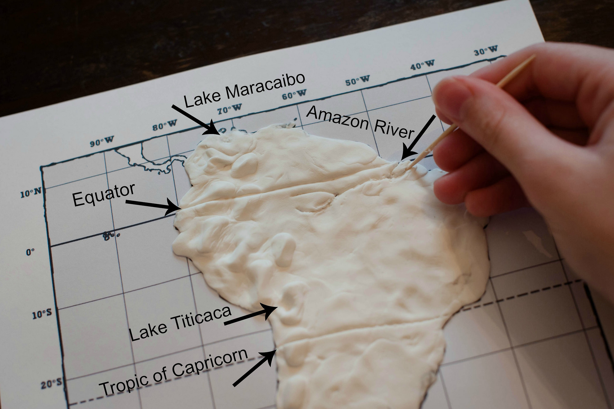
- Andes Mountains: build up the “dough” to symbolize the mountainous region of the Andes Mountains. This mountain chain is the longest in the world, running from Venezuela in the North to Chile in the South.

Note: Don’t make this mountain range too tall as these mountains will tend to break over time; in other words, make the mountain range but maintain a fairly low profile.


- Equator and Tropic of Capricorn: Use a plastic knife to carve out lines representing the Equator and the Tropic of Capricorn. Follow the gridlines on the map for proper placement of these lines. It’s interesting to note that the Galapagos Islands, Ecuador, and the mouth of the Amazon River all lie at the latitude of the Equator.


- Use a Q-tip to make indentions for Lake Maracaibo and Lake Titicaca. Lake Maracaibo is the largest lake in South America while Lake Titicaca is the highest navigable lake (in other words, the highest altitude lake on which boats navigate.)

- Use a toothpick to trace the location of the Amazon River, making your completed map look something like this:


Maps should be left out to dry for at least 24 hours. For painting instructions, go HERE.
Such a fun, hands-on way to learn your way through South America!