In this lesson, we will complete our previously created Model Magic map by painting and/or labeling our map. The following are step-by-step instructions on this process.
What you will need:
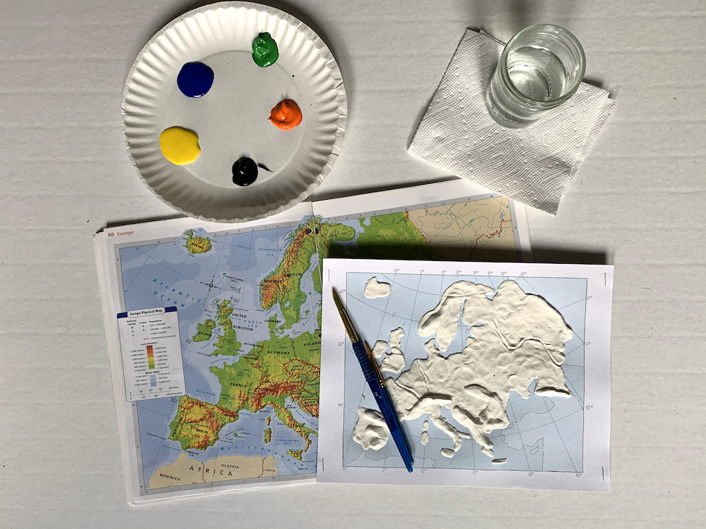
- Previously made Model Magic map
- Yellow, orange, green, blue and black acrylic paint
- Paint brushes
- Cup of water
- Paper towel
- Black pen if labeling
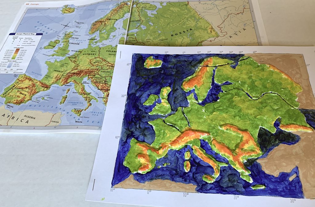
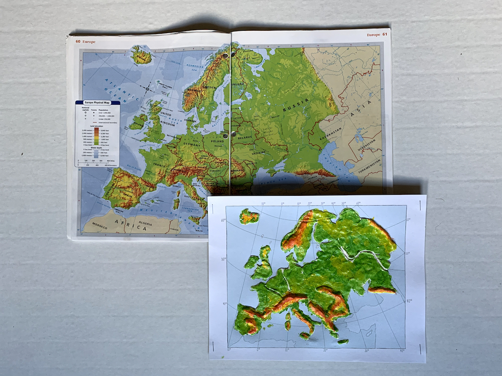
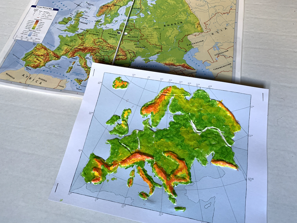
- Reference map of Europe with elevation key; See also suggestions on Map Europe Pinterest Board
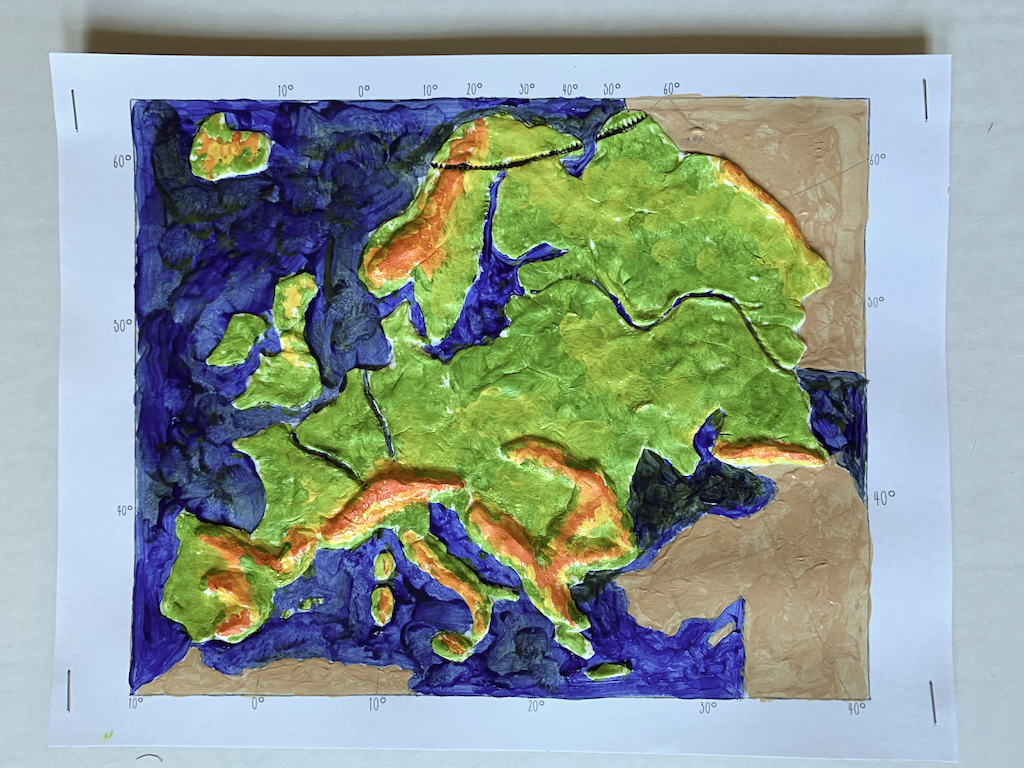
As students paint maps, make connections between what is being painted and the geographic features they represent. Use geographic points below to guide you.
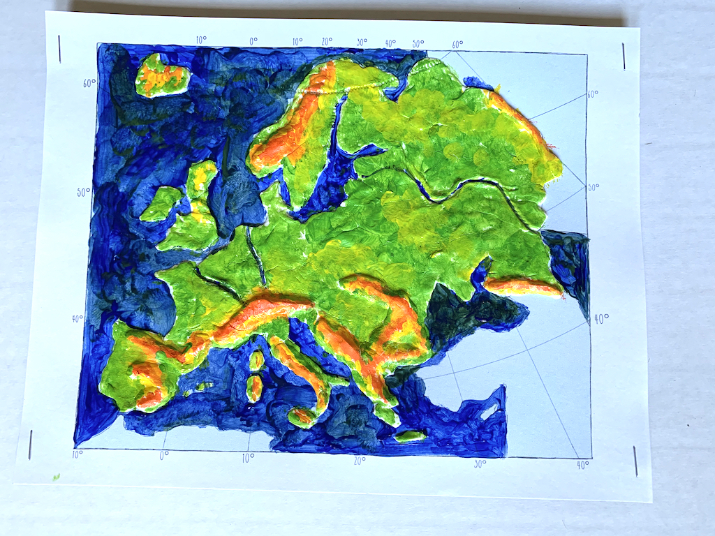
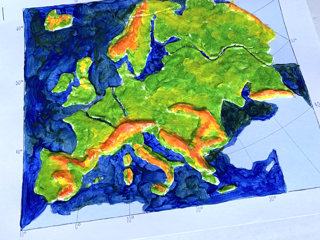
I. Paint Land Areas:
Looking at an elevation key, you will notice that different elevations are in different colors, orange representing the highest elevations and green representing the lowest elevations. Paint the mountain regions and lower elevations with colors as indicated.
Europe is notable for its many dramatic mountain ranges. A few of these mountain ranges including:
- The Alps, spanning across France, Switzerland, Italy, Liechtenstein and Austria, are arguably the most famous mountain range in Europe. The Matterhorn, standing at nearly 15,000 feet on the border of France and Italy, is the best known mountain in the Alps and a bucket list mountain for climbers.
- Scandinavian Mountains, located in Norway and Sweden, are responsible for the iconic dramatic cliffs and steep fjords for which these countries are known
- The Pyrenees Mountains (located between Spain and France); one of the legs of the famous Tour de France bike race occurs in these mountains
- Caucasus Mountains (separating Russia from Georgia in Asia); Mt. Elbrus, part of the Caucasus Mountain range in Russia, is the highest point in Europe
- Ural Mountains: this mountain range separates Russia in Europe from Russia in Asia
Other mountain ranges present that you may or may not choose to mention:
- Iberian Mountains (Spain)
- Apennine Mountain range in Italy
- Mountains across the Balkan Peninsula including the Dinaric and Carpathian Mountains
II. Label and/or paint bodies of water blue:
Of course, blue on a map represents various bodies of water.
Oceans: Atlantic Ocean to the west
Seas: Europe is unique in that it has many large and noteworthy seas. We will focus on 7 of them.
- Caspian Sea
- Black Sea
- Mediterranean Sea (which can be further divided into regional seas)
- North Sea
- Baltic Sea
- Norwegian Sea
- White Sea
Rivers:
- Volga River
- Rhine River
- Seine River
Other Noteworthy bodies of water:
- Strait of Gibraltar: separates Africa and Europe
- English Channel
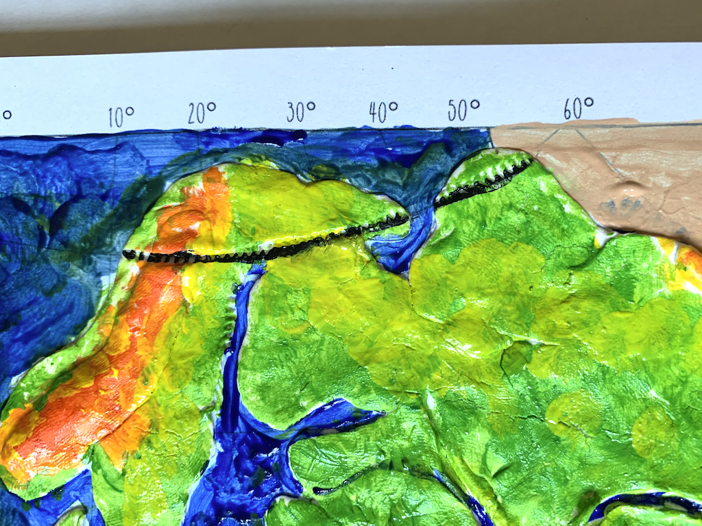
III. Paint black for the Line of Latitude representing:
- The Arctic Circle
Dramatic ocean cliffs, beautiful sea villages, rugged mountain ranges, and vast highland plateaus are just a few representative features of an absolutely beautiful continent!
What’s next? Allow maps to dry. If students are keeping a notebook, place in page protector behind Geography section of notebook.