 This year, our exciting Passport journey takes us to Europe. Of all of the continents, Europe is probably the MOST CONFUSING! Why? Because unlike some of the other continents – Africa or Australia, for example – Europe SHARES the same land mass with a different CONTINENT! Can you imagine living in a place where a 30 minute drive outside of your town takes you not just to another county… or state… or even country... but to another continent altogether! Hard to imagine, isn’t it? Well, that’s exactly the case for some people in Europe.
Adding to this confusion, the individual countries on this continent are roughly the size of states in the United States, and most of them speak their own (DIFFERENT) language! And if all of this information is not crazy enough, the political geography continues to evolve! Areas within various countries are fighting for their independence… and often gaining it. As a result, new countries emerge more often than you’d think – several even within the last decade. And finally, some countries in Europe are tough to find because they are TINY! …As in literally a dot on the map!
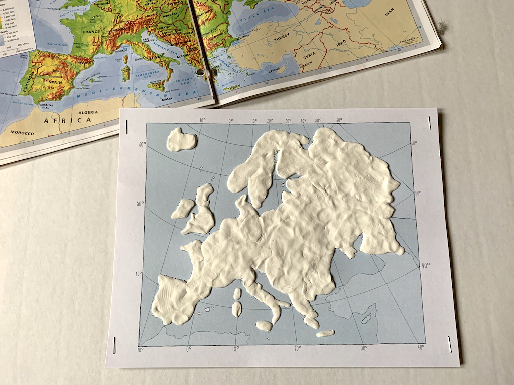
But because we’re brave and we do hard things, we’re going to take on the challenge of learning about Europe – its geography and its people. Today, in fact, we are going to be shaping a map of Europe… blurred boundary lines and all. Let’s get started!
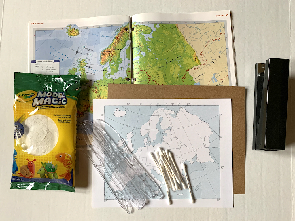
What you will need:
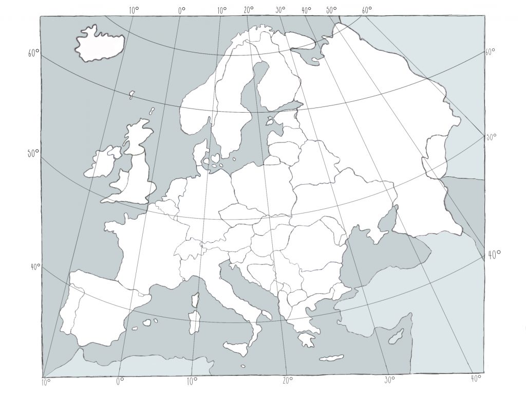
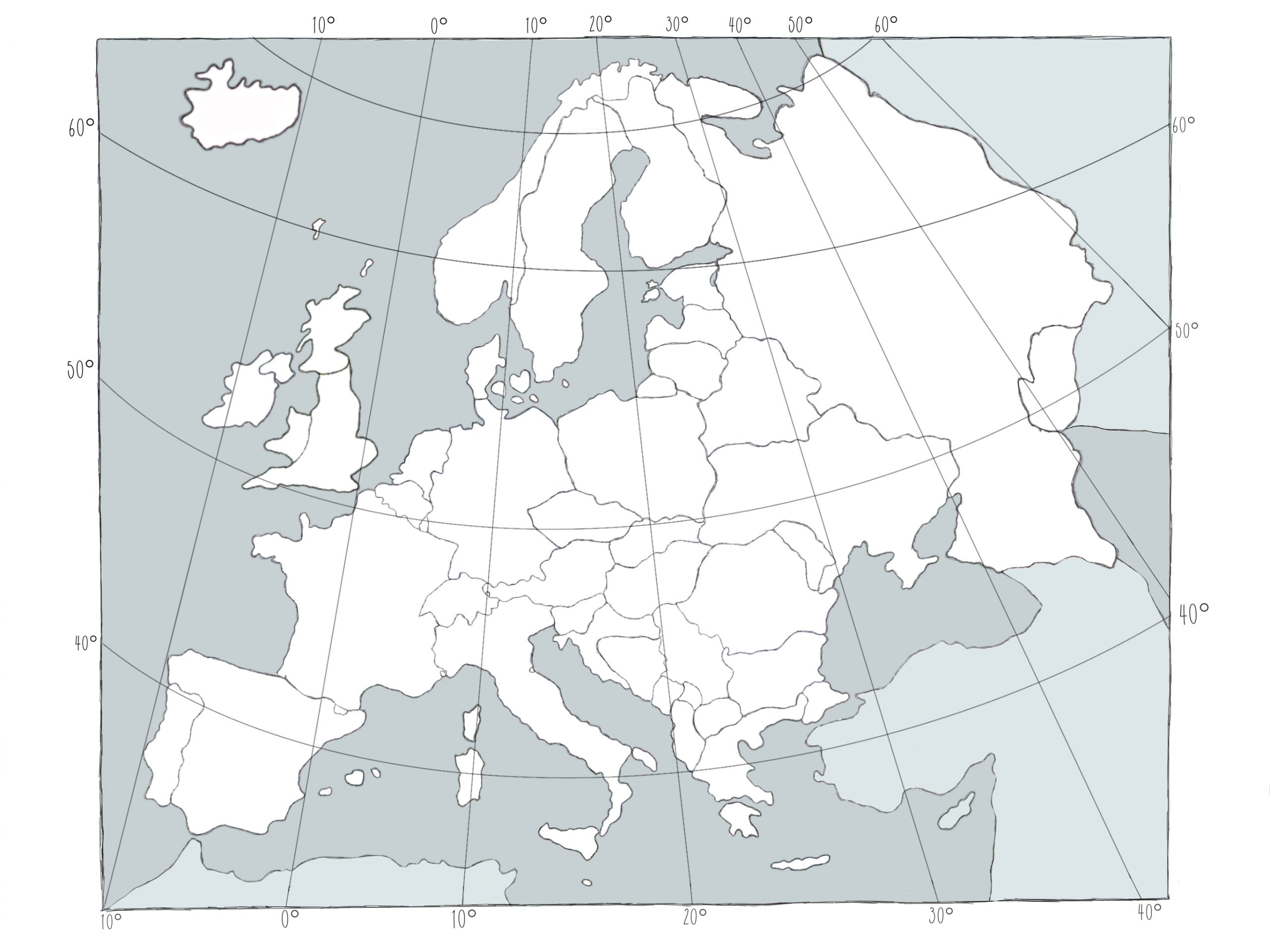
- Map of Europe, printed on card stock; 1 per child
- Tag board paper or heavyweight kraft card stock (available at your local craft store); 1 per child
- Physical map of Europe (or available in the public domain or see Map It – Europe Pinterest Board); 1 digital copy on a room screen a paper copy may be shared by 2 students (Note: check copyright guidelines before printing)
- White Model Magic, 0.5 oz. per student
- Toothpicks, Q-tips, and/or plastic knives
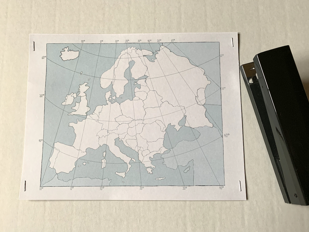
Before class, staple the map of Europe to the card stock or tag board on all four sides or corners to provide extra stability to the project.
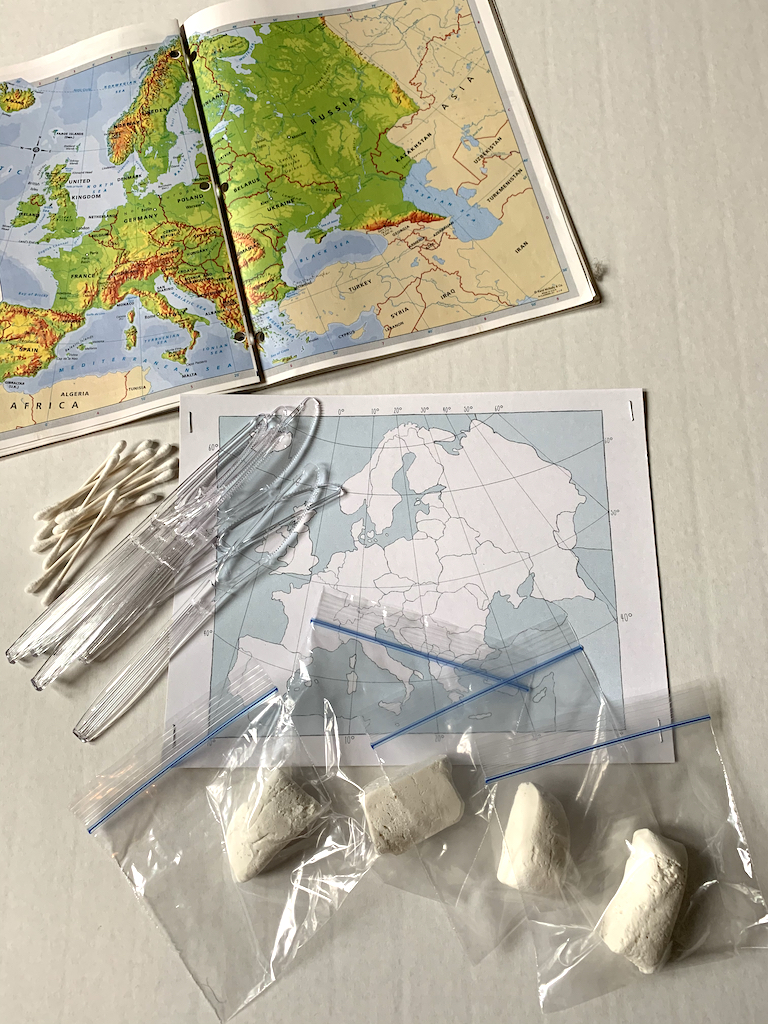
You might also choose to pre-divide the Model Magic by placing approximately a 1/2 ounce in a ziploc bag (one per student). In addition, gather toothpicks and plastic knives for students to share for creating rivers and geographic lines.
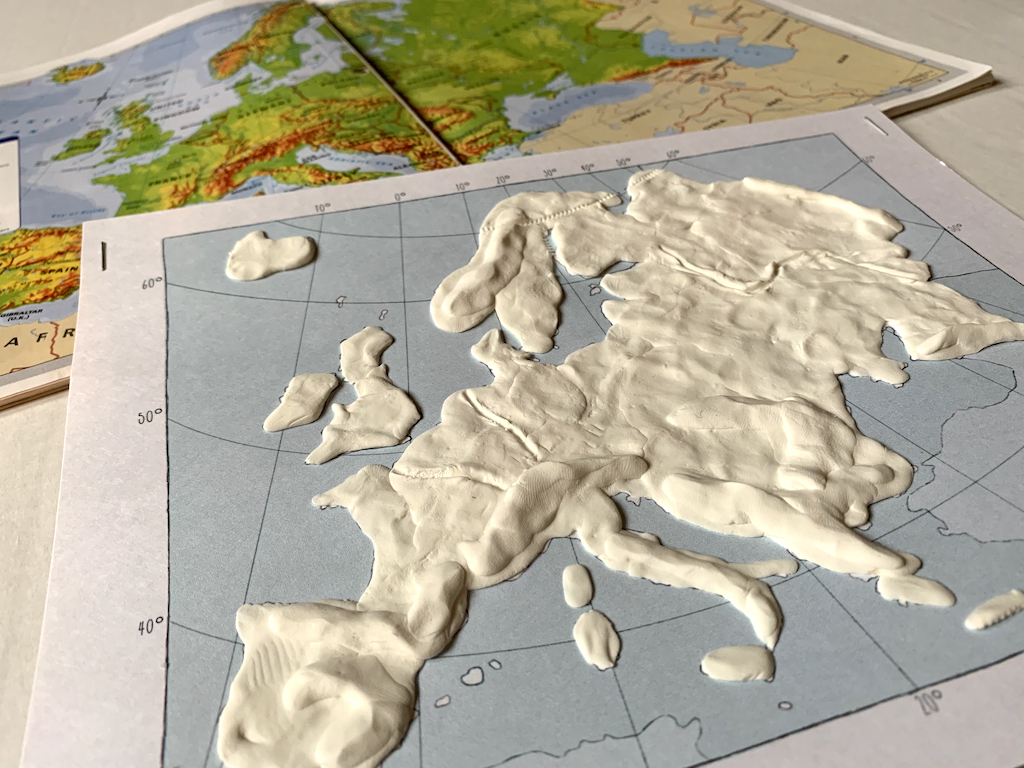
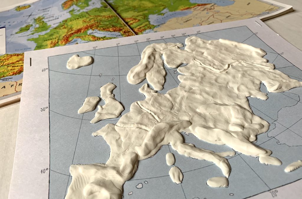
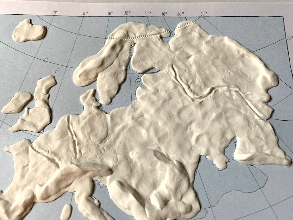
STEP 1: Fill in the boundaries of Europe with Model Magic, including the following island nations: Iceland, Ireland and the United Kingdom. Spread dough in as thin a layer as possible.
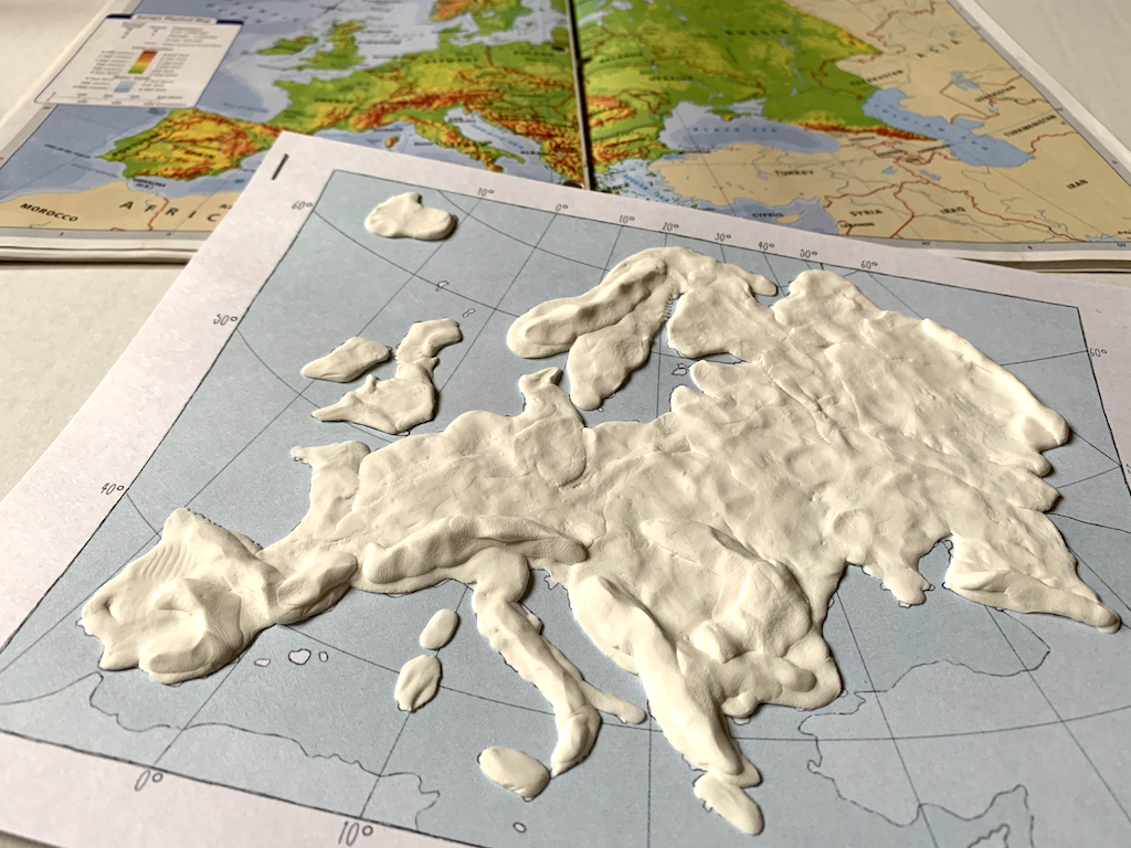
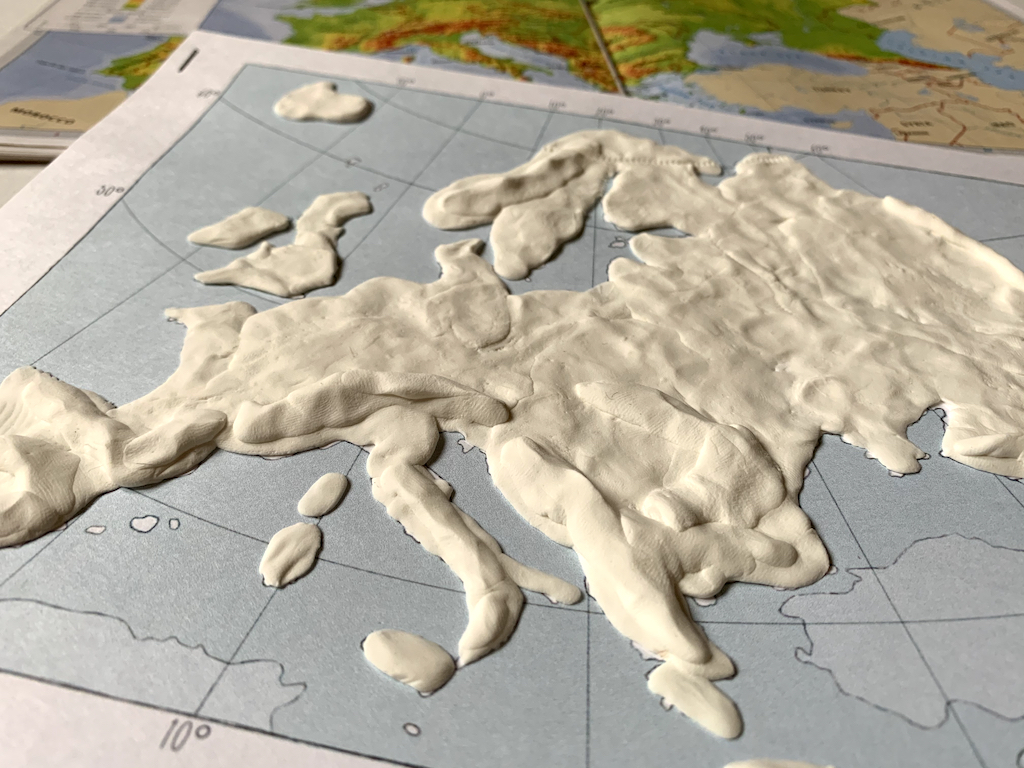
STEP 2: Once a thin layer has been pressed onto your map, build up the “dough” to symbolize the mountains of Europe. And whoa! There are a lot of mountains in Europe!
- The Alps: Probably the most well known mountain range is the Alps, the highest and most extensive mountain range system that lies entirely in Europe. The Alps span 8 Alpine countries!
- The Scandinavian Mountains: They can be found in Northern Europe in Norway and Sweden.
- The Pyrenees: This mountain range is one of three that rise up in Spain alone. The Pyrenees lie on the border between Spain and France.
- And finally, two mountain ranges create boundaries for the European continent: The Caucasus Mountains separate Europe from the Middle East and the Ural Mountains create the border between Europe and Asia.
Note: Don’t make the mountain ranges too tall as these mountains will tend to break over time; in other words, make the mountain range but maintain a fairly low profile.
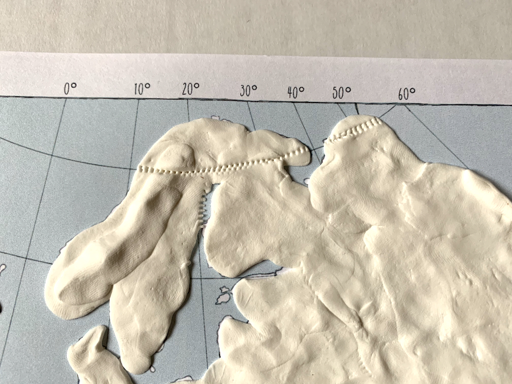
STEP 3: Arctic Circle: Use a toothpick or plastic knife to carve out a line representing the Arctic Circle Follow the gridlines on the outline map of Europe for proper placement of this line.
STEP 4: Use a toothpick to trace the approximate location of a few of the well known rivers in Europe:
- The Seine in France
- The Rhine River in Germany
- The Volga River in Russia.
Students should write their names on their maps and leave it out to dry. Once dry, the map will be painted!
What a fun, hands-on way to learn our way through the complicated, but very interesting, European continent!