

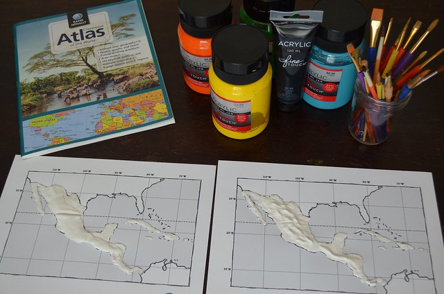
In this lesson, you will complete the Model Magic maps that were formed last week. Specifically, students will paint and label their maps. The following are step-by-step instructions on this process.
What you will need:
- Dough map from Week 1
- Yellow, orange, green, blue and black paints.
- Paint brushes
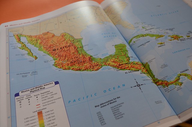
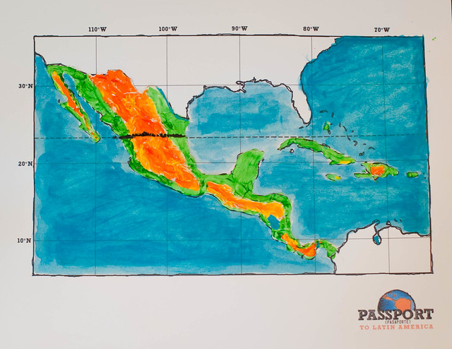
- Map of Central America with elevation key
Paint Land Areas:
Looking at an elevation key you will notice the different elevations are in different colors. Imitate the map with your painting. Paint the mountain regions and lower elevations with colors as indicated. Paint the small islands that were not able to be covered with Model Magic green.
Note: the mountain range in Mexico continues down into the Central American isthmus (a narrow strip of land that connects two land masses and separates two bodies of water).
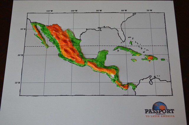
Paint a black line over the area of the Tropic of Cancer (an imaginary line that represents the angle of the earth’s tilt on its axis – 23.5 degrees).
Note: The area between the Tropic of Cancer in the Northern Hemisphere and the Tropic of Capricorn in the Southern Hemisphere is known as the Tropics. This area is characterized by hot, humid weather, a lack of season changes, and is the area on our planet where all of the earth’s rainforests exist.
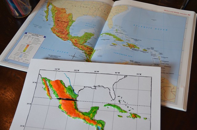
Label and/or paint oceans, rivers and lakes:
Option 1:
Paint a thin layer of blue over the ocean areas, as well as the areas of the Caribbean Sea and the Gulf of Mexico. Paint in Lake Nicaragua, the Rio Grande River, and the Panama Canal. With this option you will NOT do any labeling.
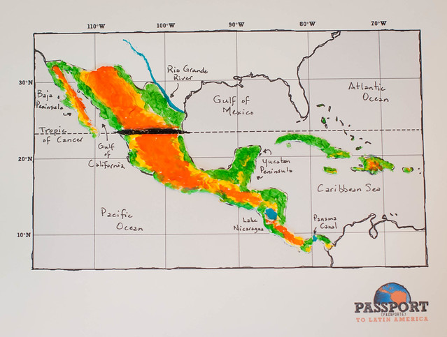
Option 2 (for older / more advanced students): Do NOT paint the ocean or sea areas, instead leave this area blank for labeling. DO paint Lake Nicaragua, the Rio Grande River, and the Panama Canal with blue. Label:
- Tropic of Cancer
- Pacific Ocean
- Atlantic Ocia
- Caribbean Sea
- Gulf of Mexico
- Gulf of California
- Lake Nicaragua
- Panama Canal
- Rio Grande River
-
- Baja Peninsula
- Yucatan Peninsula
Allow maps to dry. And that’s it! Place in page protector and place in Geography section of notebook if desired.