
This year we are going to learn about Latin America. Latin America is not a continent like Africa, Europe or Asia. Instead, it is an area that spreads over part of North, and most of South America, and also includes many Caribbean Islands.
Today we are going to be shaping a map of Mexico, Central America, and the Caribbean.
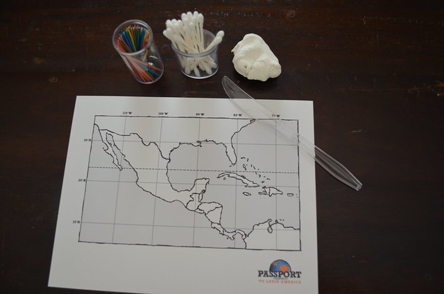
What you will need:
Download Central America Grid Map, print on cardstock
Model Magic, 0.5 oz. per student
Assorted toothpicks, Q-tips and plastic knives
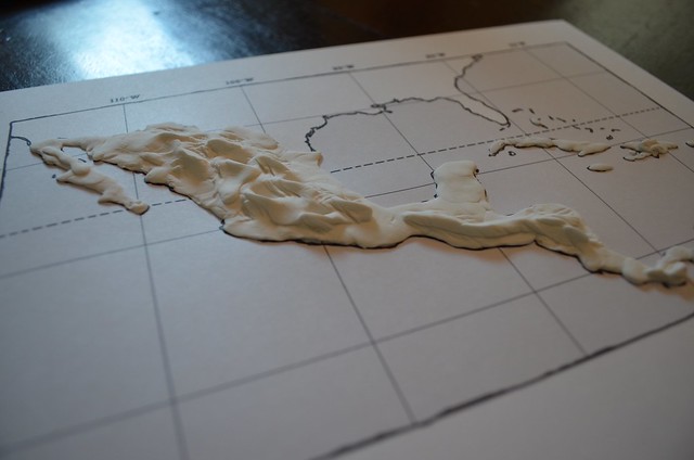
Instructions: Fill in the areas of Mexico, Central America and the Caribbean Islands. Many of these are small, so just try your best to cover them. Spread dough in as thin a layer as possible. 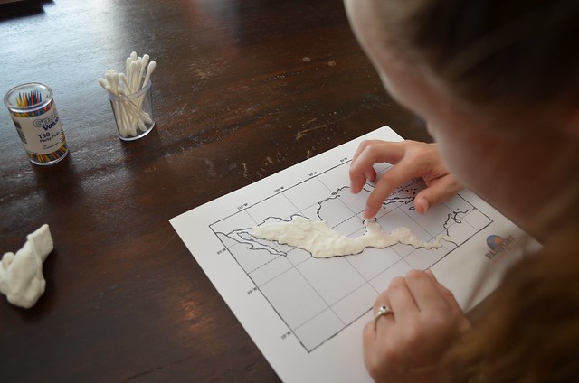
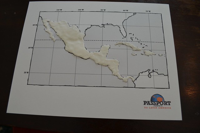
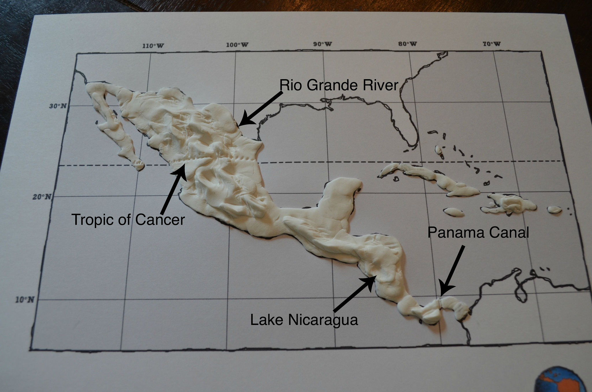
Once a thin layer has been pressed onto your map, build up the “dough” to symbolize the mountainous region of the Sierra Madre Mountains in Mexico and the mountain range as it extends into Central America.
Note: Don’t make this mountain range too tall as these mountains will tend to break over time; in other words, make the mountain range but maintain a fairly low profile.
Use a plastic knife to carve out a line representing the Tropic of Cancer. Follow the gridlines on the outline map for proper placement of this line.
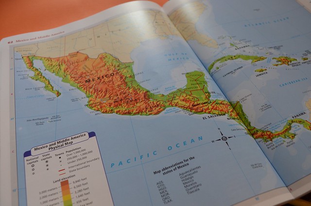
Use a Q-tip to make the indention for Lake Nicaragua. Use a toothpick to trace the Rio Grande River and the Panama Canal (see a map for location of these features).

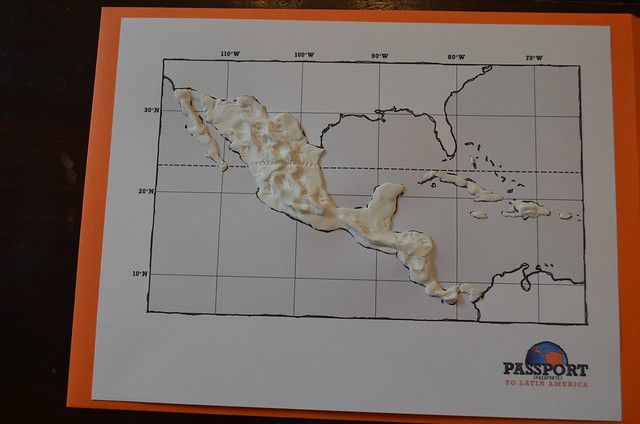
Leave your map out to dry. Next week we will paint and label our maps! Such a fun, hands-on way to learn your way through Central America!