
Want to learn to identify the countries located in South America? The country cards that follow show the outline of the country within the context of the continent on which it is located. In addition, each card includes the capital and important physical features in each country (such as well known rivers, oceans, mountains, etc). The country outline is shown first. Try and identify the country before scrolling to see the answer. Then take a minute to find each of the features listed below each card.
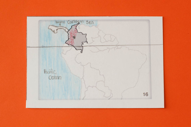
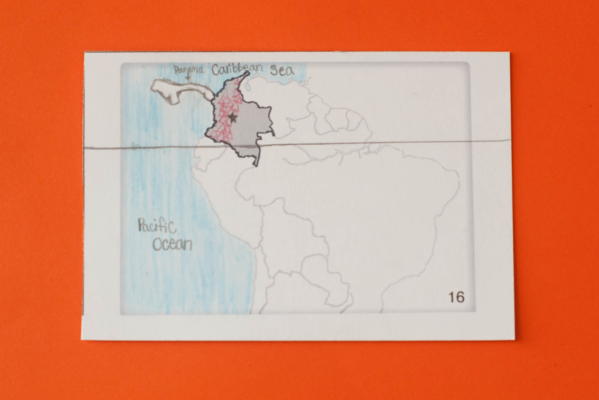
16. Colombia
- Bogota (capital)
- Andes Mountains
- Equator
- Panama
- Caribbean Sea
- Pacific Ocean
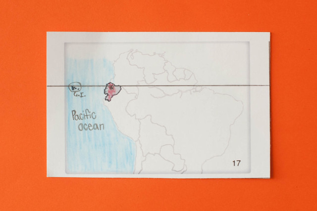
17. Ecuador
- Quito (capital)
- Andes Mountains
- Equator
- Pacific Oceans
- Galapagos Islands
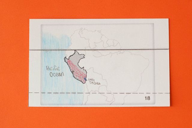
18. Peru
- Lima (capital)
- Equator
- Tropic of Capricorn
- Andes Mountains
- Lake Titicaca
- Pacific Ocean
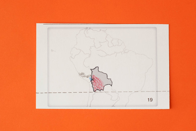
19. Bolivia
- La Paz (capital)
- Tropic of Capricorn
- Andes Mountains
- Lake Titicaca
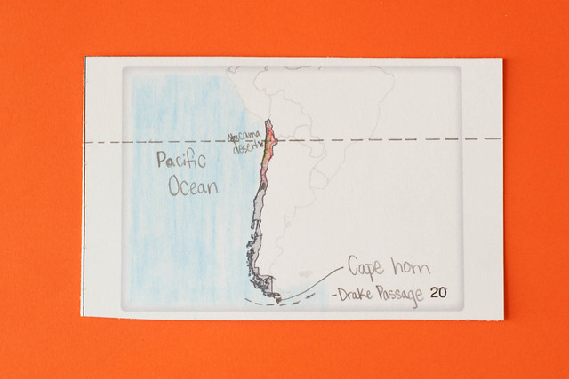
20. Chile
- Santiago (capital)
- Andes Mountains
- Tropic of Capricorn
- Atacama Desert
- Cape Horn (the southernmost island)
- Drake Passage
- Pacific Ocean
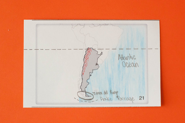
21. Argentina
- Buenos Aires (capital)
- Andes Mountains
- Tropic of Capricorn
- Tierra del Fuego
- Drake Passage
- Atlantic Ocean
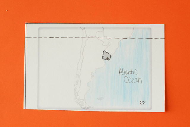
22. Uruguay
- Montevideo (capital)
- Tropic of Capricorn
- Atlantic Ocean
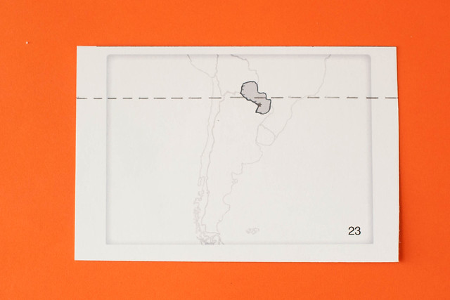
23. Paraguay
- Asuncion (capital)
- Tropic of Capricorn
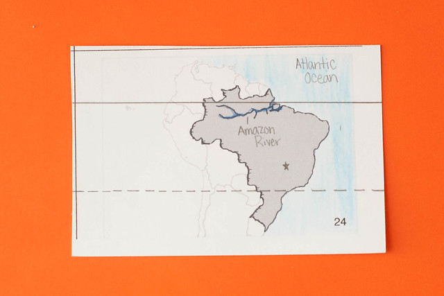
24. Brazil
- Brasilia (capital)
- Amazon River
- Equator
- Tropic of Capricorn
- Atlantic Ocean
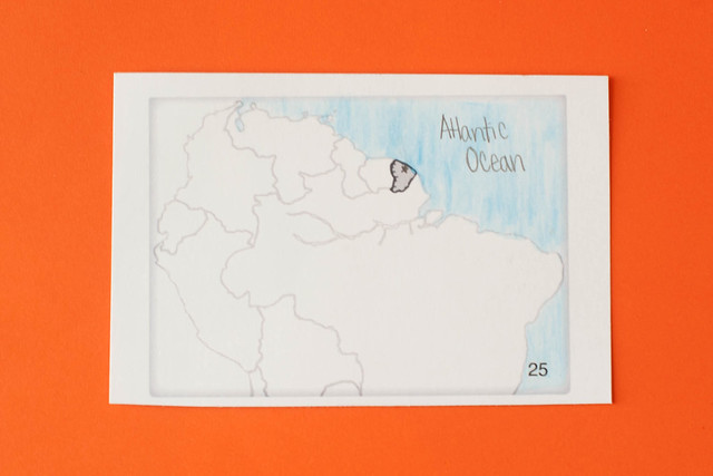
25. French Guiana
- Cayenne (capital)
- Atlantic Ocean
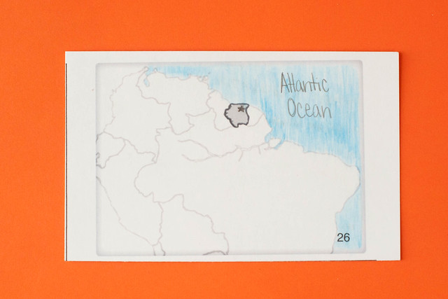
26. Suriname
- Paramaribo (capital)
- Atlantic Ocean
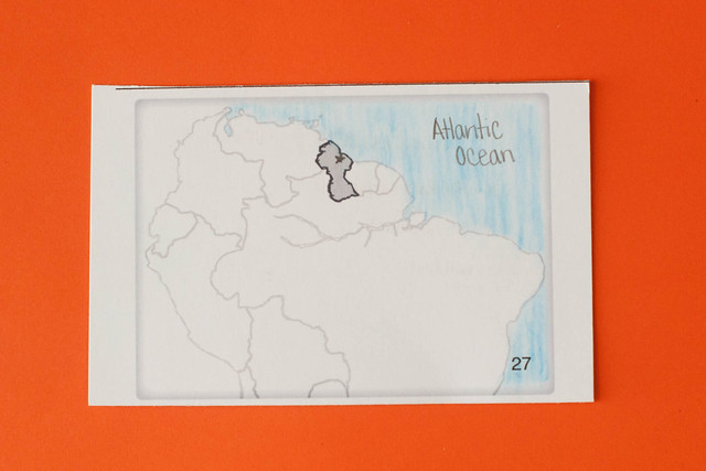
27. Guyana
- Georgetown (capital)
- Atlantic Ocean
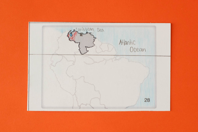
28. Venezuela
- Caracas (capital)
- Lake Maracaibo
- Andes Mountains
- Equator
- Caribbean Sea