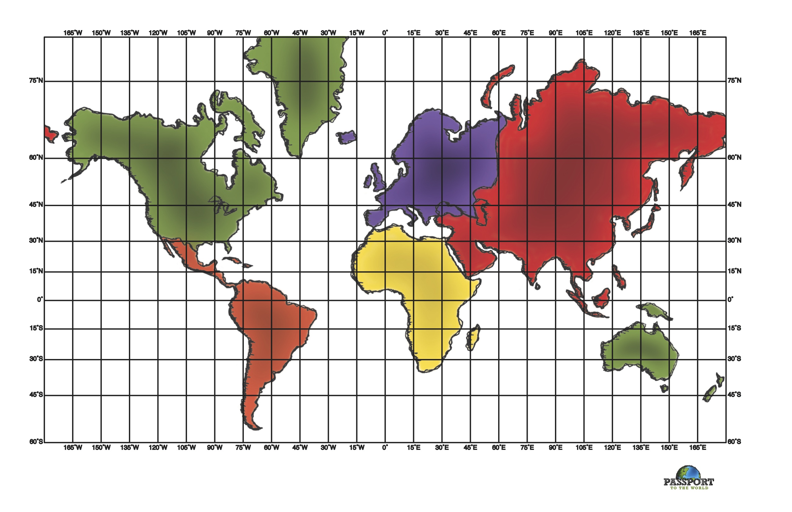

Want to learn to identify the countries located in Central America and the Caribbean? The country cards that follow show the outline of the country within the context of the continent on which it is located. In addition, each card includes the capital and important physical features in each country (such as well known rivers, oceans, mountains, etc). The country outline is shown first. Try and identify the country before scrolling to see the answer. Then take a minute to find each of the features listed below each card.
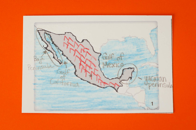
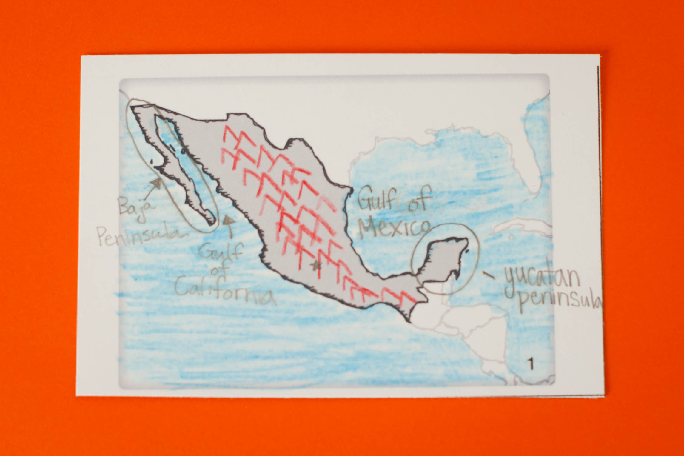
1. Mexico
- Mexico
- Mexico City (capital)
- Rio Grande River
- Sierra Madre Mountains
- Yucatan Peninsula
- Baja Peninsula
- Gulf of California
- Gulf of Mexico
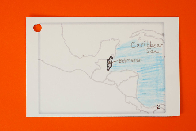
2. Belize
- Belmopan (capital)
- Caribbean Sea
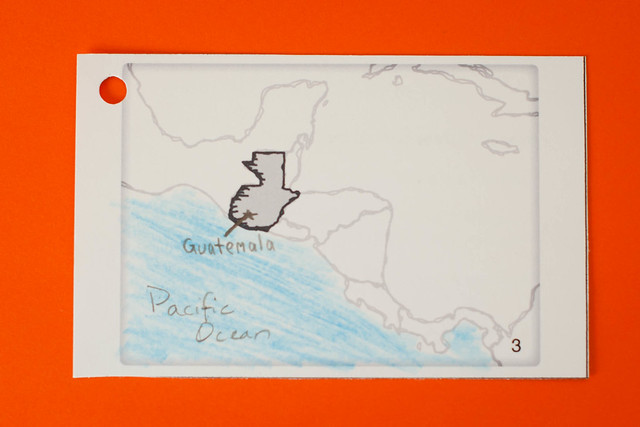
3. Guatemala
- Guatemala City (capital)
- Pacific Ocean
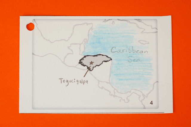
4. Honduras
- Tegucigalpa (capital)
- Caribbean Sea
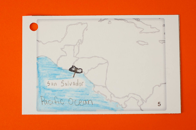
5. El Salvador
- San Salvador
- Pacific Ocean
-
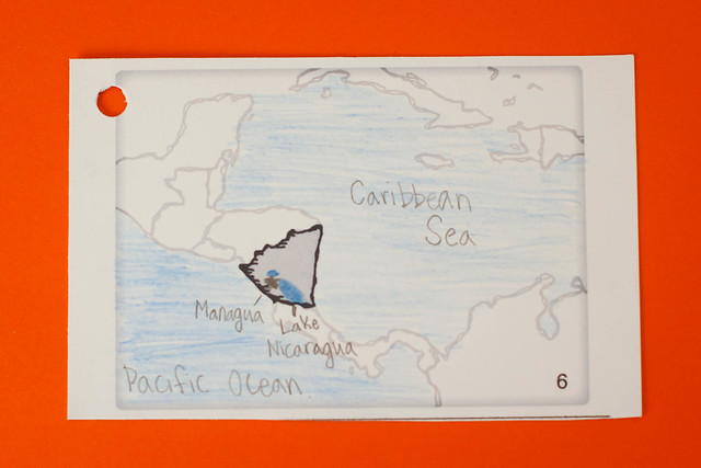
6. Nicaragua
- Managua (capital)
- Lake Nicaragua
- Pacific Ocean
- Caribbean Sea
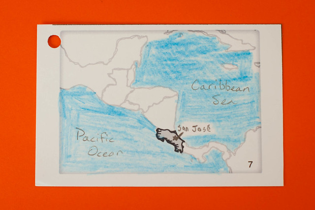
7. Costa Rica
- San Jose (capital)
- Pacific Ocean
- Caribbean Sea
-
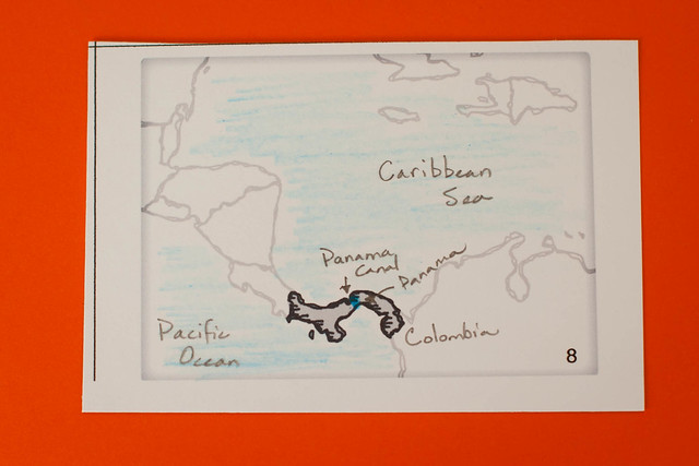
8. Panama
- Panama City (capital)
- Panama Canal
- Colombia
- Pacific Ocean
- Caribbean Sea
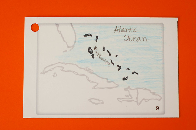
9. Bahamas
- Nassau (capital)
- Atlantic Ocean
-
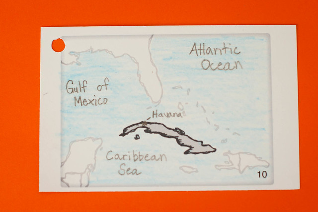
10. Cuba
- Havana (capital)
- Gulf of Mexico
- Caribbean Sea
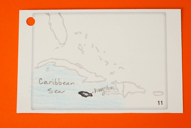
11. Jamaica
- Kingston (capital)
- Caribbean Sea
-
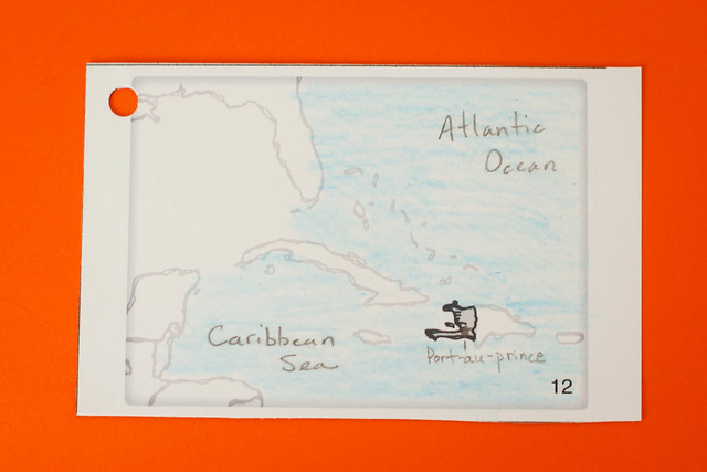
12. Haiti
- Port-au-Prince (capital)
- Caribbean Sea
- Atlantic Ocean
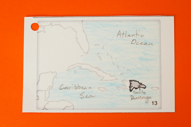
13. Dominican Republic
- Santo Domingo (capital)
- Atlantic Ocean
- Caribbean Sea
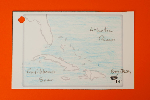
14. Puerto Rico
- San Juan
- Atlantic Ocean
- Caribbean Sea
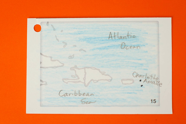
15. Virgin Islands
- Charlotte Amalie (capital)
- Atlantic Ocean
- Caribbean Sea