Looking for a couple of SIMPLE but EFFECTIVE ideas for reinforcing the European country names and their geographical locations? Look no further! These ideas may seem simple, but they pay big dividends in helping students learn and memorize the numerous, and often confusing lists of European countries.
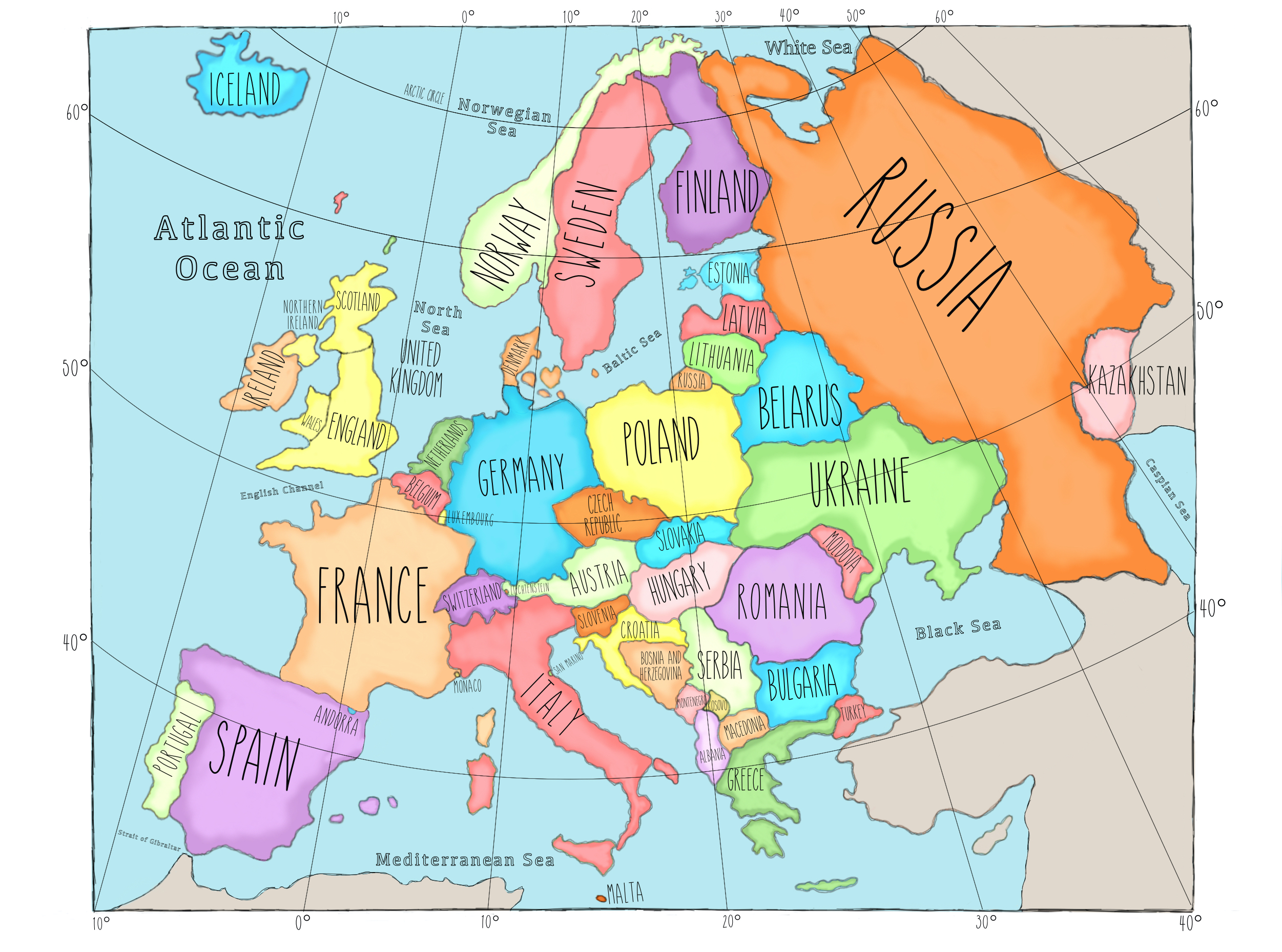
Before we continue, let’s take a moment to recognize that discrepancies exist over which continent some of the countries are located. As a result, our list is not without controversy. For example, Iceland sits on the continental plates that separate Eurasia from North America (making it part of both). Geographically, it is closest to Greenland (considered part of North America), therefore, by the rule of land proximity, it could be considered part of North America. On the other hand, culturally and politically, Iceland aligns itself with the Scandinavian countries of Europe. As a result, Iceland is usually cited in the list of European countries. Therefore, we also include Iceland in Europe. Another controversial country, Cyprus, is sometimes mentioned in European lists because many people with Greek heritage live in Cyprus. However, it is extremely close to Turkey, so by the rule of geographic proximity, it is considered part of Asia. Since many (arguably most) lists do not include Cyprus in Europe, we don’t include it either. We save Cyprus for Asia. Finally, because Europe has a “soft” Eastern and Southern border (mountain ranges and a river) the boundary lines of Europe result in a few countries straddling two continents, Europe and Asia. Five countries are often included in this category of trans-continental countries: Russia, Turkey, Kazakhstan plus Azerbaijan and Georgia. For the purposes of clarity for our age group of students (elementary school target age), we include the three countries that are clearly trans-continental, Russia, Turkey and Kazakhstan. As most of Georgia and Azerbaijan are located in Asia, we study these countries in Passport to Asia. These considerations allowed us to land on a model of 50 European countries, with the goal of improving memorization and reducing confusion!
Before class, download and print the following labeled map of Europe. This may be printed at your local print shop in large format for classroom display (24″ x 36″), or you may print an individual map for each student to assist in mapping activities.
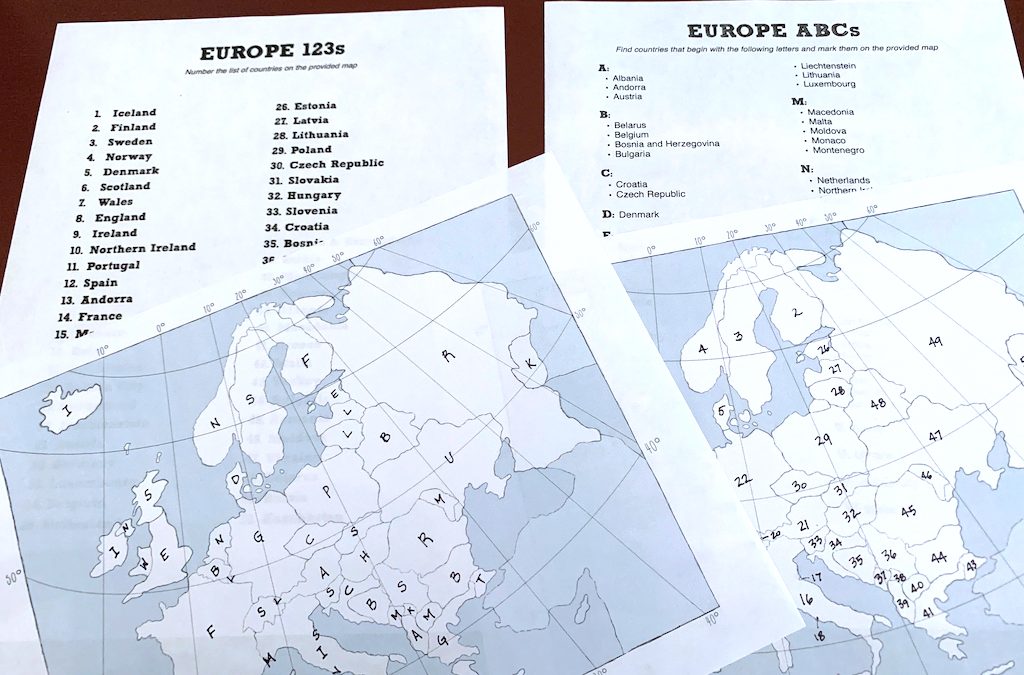
EUROPE ABCs
What You Will Need:
- Labeled map of Europe for reference (see above)
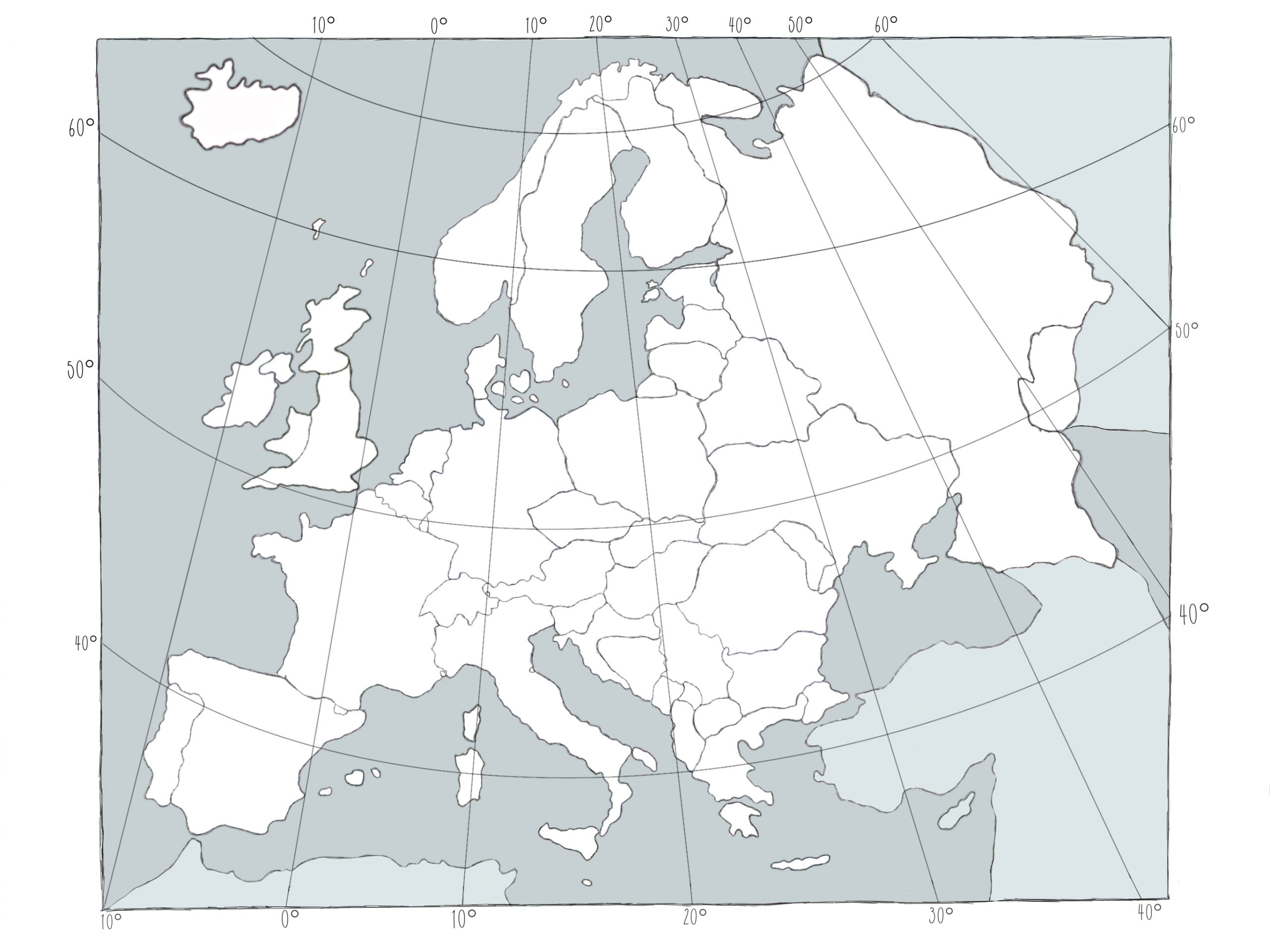
- Blank map of Europe; one per student
- Europe ABCs list of countries; one per student
- Pencil or pen; one per student
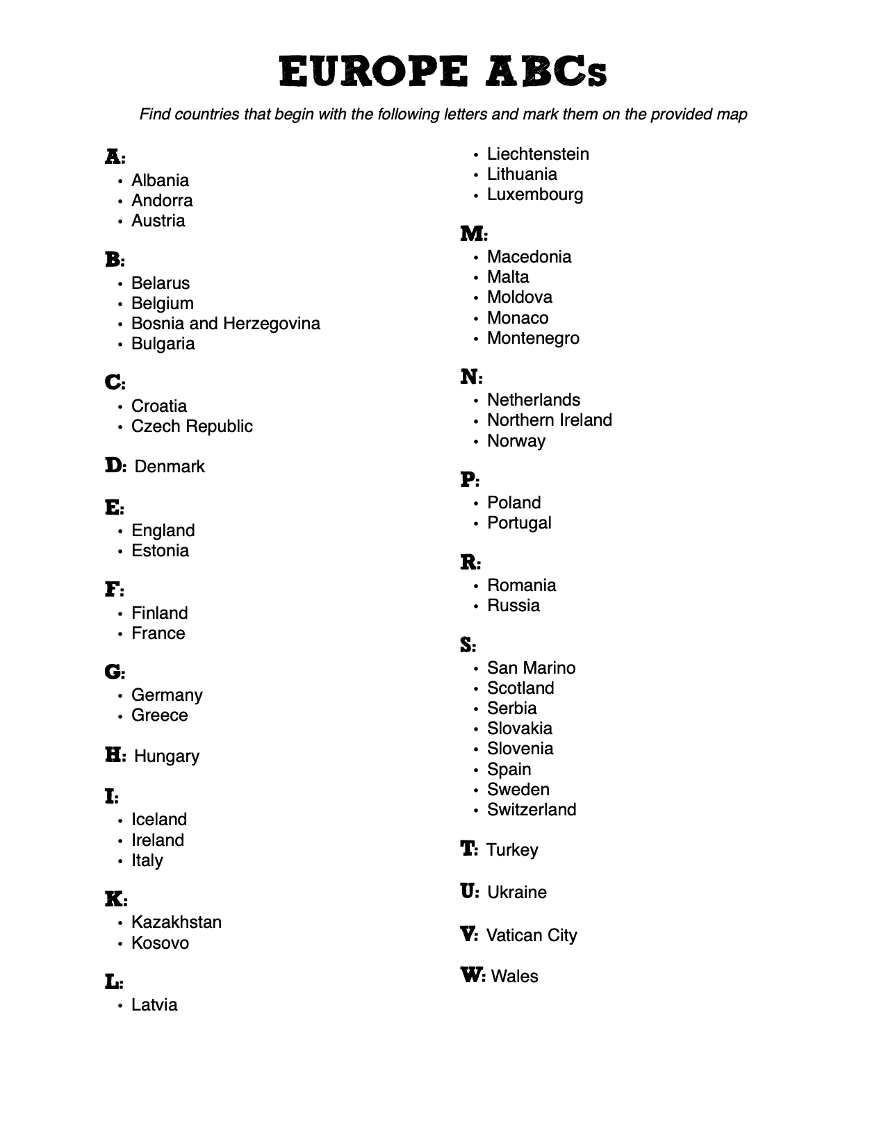
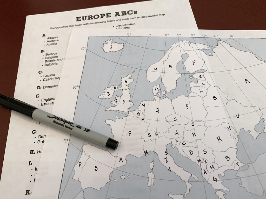
In the following activity, the countries are under the letter with which they start. Using the labeled Passport map for assistance, students should work their way through the alphabetical list by finding each country on the reference map, and then labelling that country on the blank map with its corresponding first letter.
This process allows students another way to gain a point of reference for each country’s name and location (ie. countries with the same letter).
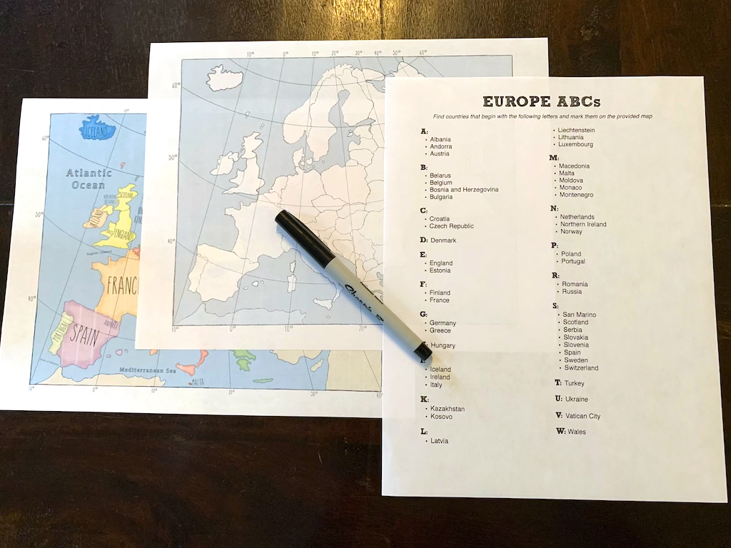
The finished product should look similar to this:
EUROPE 123s
Remember, our country list includes 50 countries.
What You Will Need:
- Labeled map of Europe for reference
- Blank map of Europe; one per student
- Europe 123s list of countries; one per student
- Pencil; one per student
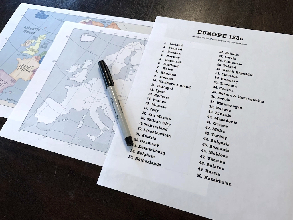
Distribute a copy of the blank map of Europe and the Europe 123s List of Countries to each student. In addition, each student should have access to a labeled map of Europe.
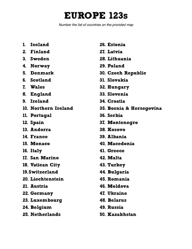
Using the labeled map for reference, students should locate each numbered country on the reference map, then mark the country with its corresponding number on their blank map.
Note: some countries are TINY (literally a dot on the map) and hard to find.
When complete, activity will look something like this:
