In this lesson, we will complete the Model Magic maps by painting and labeling the maps. The following are step-by-step instructions on this process.
What you will need:
- Map with Model Magic
- Yellow, orange, green, blue and black acrylic paint
- Paint brushes
- Cup of water
- Paper towel
- Black pen if labeling
- Reference map of South America with elevation key
Paint Land Areas:
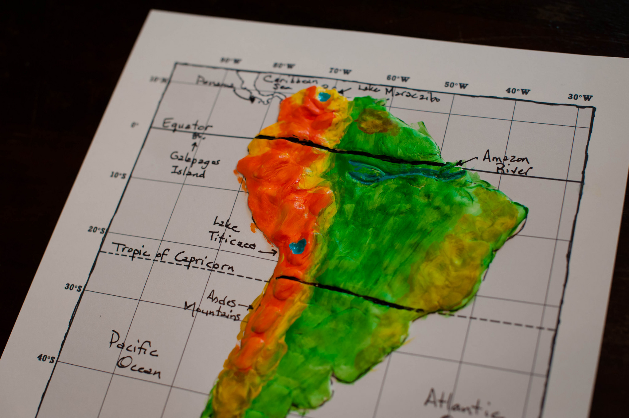
Looking at an elevation key you will notice the different elevations are in different colors. Students should imitate the map with their painting. Paint the mountain regions and lower elevations with colors as indicated.
Label and/or paint oceans, rivers and lakes:
Option 1:
- Paint blue in Lake Maracaibo, Lake Titicaca and the Amazon River.
- Paint black over the Equator and Tropic of Capricorn.
- Paint blue over the ocean areas.
With this option you will NOT do any labeling.
Option 2 (older or more advanced students):
- Do NOT paint ocean area blue.
- Do paint blue for Lake Maracaibo, Lake Titicaca and the Amazon River.
- Paint black over the Equator and Tropic of Capricorn.
- Label:
- Andes Mountains
- Amazon River
- Atlantic Ocean
- Caribbean Sea
- Drake Passage
- Equator
- Galapagos Islands
- Lake Maracaibo
- Lake Titicaca
- Pacific Ocean
- The Falkland Islands
- The Straight of Magellan
- Tropic of Capricorn


Allow maps to dry. And that’s it! If students are keeping a notebook, place in page protector and place in Geography section of notebook.


